


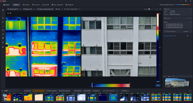

CRITIR imports thermal imagery from more than 16 verified thermal cameras models across six manufacturers — including FLIR, DJI, Fluke and Skydio — and generates georeferenced infrared orthomosaics for large-area surveys.
ASOLAB Inc., a Japanese drone-services and technology company, today announced that CRITIR, an infrared (thermal) inspection and mapping software built for solar, infrastructure and other large-area thermal work, is available to U.S. customers. CRITIR imports thermal imagery from a wide range of camera manufacturers — with compatibility verified across more than 16 models from six brands — and generates georeferenced infrared orthomosaics, allowing inspection teams to standardize their analysis regardless of the hardware they use.
Drones and thermal cameras have become established tools for infrastructure inspection, yet ASOLAB saw a gap: that data was still hard to consolidate across brands and put to use.
The company built CRITIR to close it — and, given how versatile thermal data is, to support infrared work broadly rather than a single use case.
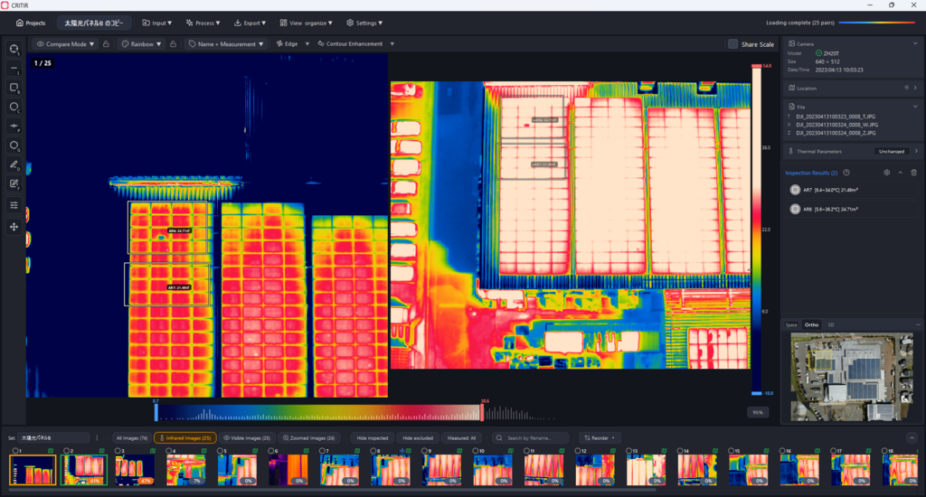
CRITIR offers two key capabilities, and the company is putting them side by side for the U.S. market:
Works with the cameras you already use. CRITIR has been verified with more than 16 thermal cameras across six manufacturers — DJI, FLIR, HIKMICRO, Fluke, Skydio and NEC Avio — letting teams consolidate mixed fleets, drone and handheld captures, and existing thermal data into a single workflow, with no lock-in to one brand.
Infrared orthomosaics. CRITIR stitches thermal imagery into georeferenced IR maps, making it practical to survey an entire solar site or a stretch of infrastructure in one deliverable — and to compare conditions over time.
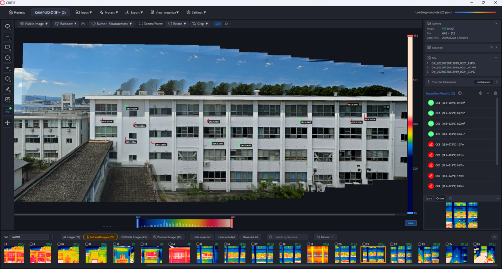
In the U.S., drone-based thermal inspection is growing fastest in solar and infrastructure, where assets are large, distributed and costly to inspect by hand. Teams frequently operate more than one camera brand, and manual thermal image analysis is time-consuming and difficult to standardize. CRITIR automates much of the capture-to-report workflow without tying customers to specific hardware — or to a single use case.
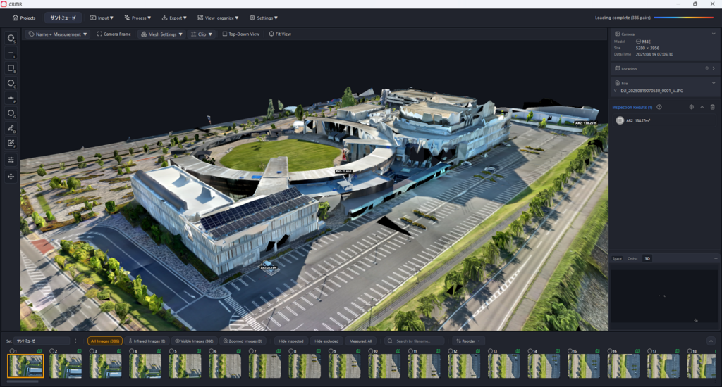
CRITIR is offered in two editions: Light, which provides core analysis and a simple PDF report, and PRO, which adds the full feature set — including infrared orthomosaic generation — plus unlimited additional captures. Advanced 3D visualization and AI-assisted analysis are in development and planned for future releases.
“Inspection teams shouldn’t have to choose their software based on the camera they use. CRITIR takes imagery from the cameras they already own, turns it into an infrared orthomosaic, and lets them inspect solar sites, infrastructure and more from one platform,” said Tetsuya Okuda, Business Operations Manager, ASOLAB Inc.
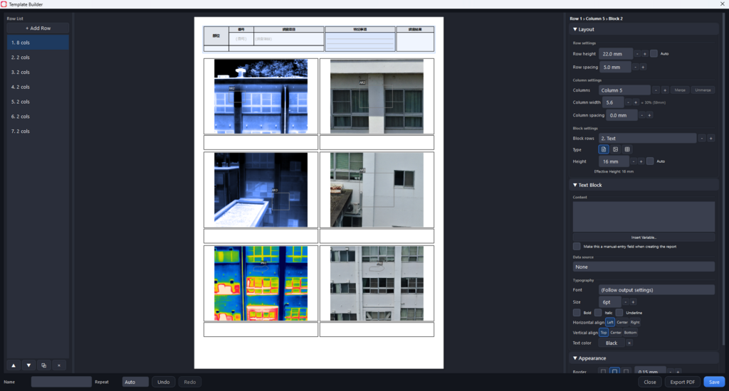
In Japan, where CRITIR is also used for building (exterior-wall) inspection, a distribution partner reported an estimated 30–50% improvement in diagnostic efficiency. Results vary by application, equipment and workflow.
CRITIR is available now and can be ordered worldwide, including from the U.S. Light and PRO editions are offered, along with a free trial; current pricing is available at critir.jp.
About ASOLAB
ASOLAB Inc. is a drone-services and technology company based in Matsumoto, Nagano, Japan. The company develops software and delivers field operations across infrastructure inspection, forestry and aerial logistics, helping organizations adopt drones for safer, more efficient work. Learn more at critir.jp.